


(Left) Downtown Columbia, looking north from the corner of Main and Hampton streets. On June 24, 1905, Sylvan Brothers moved to the corner of Main and Hampton. A year later, they installed a beautiful four-sided clock on the sidewalk in front of the store.
(Right) Today, the Sylvan Building is listed on the National Register of Historic Places, and the Sylvan’s clock is a cherished local landmark.


(Left) From State House looking north today. Trolley lines have been replaced with bustling car and pedestrian traffic.
(Right) From State House looking north about 1915. City Hall is at left.


(Left) The State House prior to 1895. Columbia was the location of South Carolina’s second state house. In 1786, the South Carolina Assembly voted to move the state capital from Charleston to Columbia.
(Right) The South Carolina State House today.


(Left) Looking south today at the corner of Assembly and Laurel streets. The Columbia skyline has changed dramatically over the past 100 years.
(Right) Looking south in 1912. In the foreground is the Robertson Mansion at corner of Assembly and Laurel streets.
![]()

(Left) Trolley staff outside a trolley transfer station at the same location, around the turn of the century.
(Right) Corner of Main and Gervais streets, today home to WOLO-TV, Columbia’s ABC affiliate, and The Whig.


(Left) Richland County Sheriff’s Department currently employs more than 600 uniformed officers and 140 non-sworn personnel, making it one of the largest law enforcement agencies in the state.
(Right) The Sheriff’s Department in the early 1900s.


(Left) North Main Street Trolley, possibly Eau Claire section, where just a few houses and a trolley line dotted the street.
(Right) North Main Street today.


(Left) The corner of Main and Elmwood today.
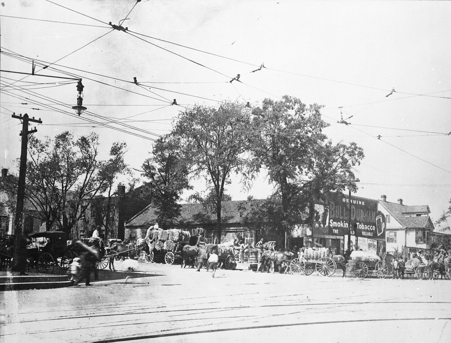
(Right) “Cottontown,” Corner of Main and Elmwood. The area was known as Cotton Town, named after the cotton exchange warehouses that opened there. Grocery wholesale and retail establishments also operated in the area.